


 Source: http://thassos.gr
 13/08/2017 - 13/08/2017
HOTELS
APARTMENTS
CAMPING
AGROTOURISM ACCOMMODATION
Traveler's Guide
East Macedonia & Thrace
Region of East Macedonia & Thrace
The Region of Eastern Macedonia and Thrace occupies the northeastern part of Greece. It borders with Turkey easterly, Bulgaria northern and with the Regional Unit of Serres westerly. Southwest is washed by the Aegean Sea and southeast by the Thracian Sea. It includes the Regional Unities: Drama, Kavala, Xanthi, Rodopi and Evros.
It has a total area of 14.157 thousand hectares and covers the 10.7% of the total area of the country.
Also includes two major islands of Thracian Sea, Thassos and Samothrace.
Crossroad of major sea and land routes by which, for thousands of years, are moving people and goods, ideas and habits to and from the four cardinal points: from the Black Sea and Asia to Western Europe and from North Europe and the Balkans to the Mediterranean and North Africa.
The traces of its history, that start from the Paleolithic season and arrive to our days, are everywhere: caves, rock paintings, forts, temples, theaters, citadels, mines, graves, tumuli, marble quarries, Christian monuments, monasteries and holy places , aqueducts, Islamic monuments, traditional villages, Megara, mansions, tobacco warehouses.
The Region of Eastern Macedonia and Thrace, during the ancient times, was covered by forests at the rate of about 80%, but today this percentage has limited to 55% per area. In its extent there are trackless forests, virgin nature, high mountains, rich flora and fauna, large rivers, lakes and lagoons and an endless coastline with clear blue waters and friendly beaches.
The region is a place of music, dance, feast and ritual. Dionysus and Orpheus never left from this earth. The reversals of nature (winter, spring, etc.) give an opportunity for reversals of another class: masquerading and walking over fires, and outspoken sprees, kidnappings and robberies, all in the context of ritual.
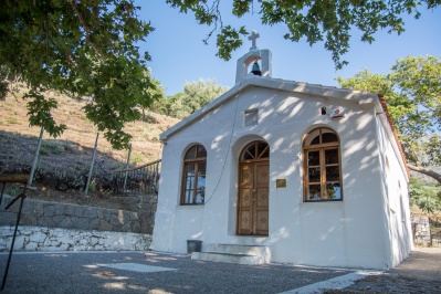
Pamouktsoglou House
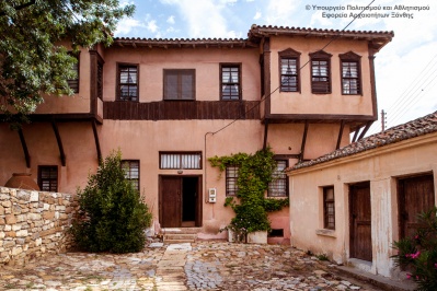 Going up the narrow alleyways of the traditional settlement of Avdira, which lies on the north side of the village over the imposing square, we find the impressive mansions with ...
Old Town of Xanthi
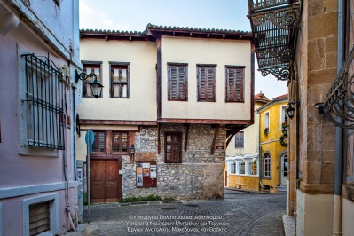 The Old Town of Xanthi is located in the north of Xanthi constituting its historic core and covers an area of 380.000m2. The city is built after 1829. The year ...
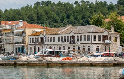
Roman portico in Agios Charalambos, Maroneia
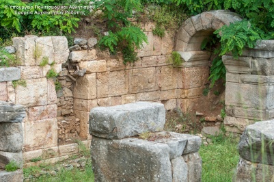 At the end of the road leading from Maroneia the port of Agios Charalambos, is located a monumental Roman marble portico built in the area. This portico was leading to ...
Pew of Paul the Apostle
 Samothrace was the first European territory that the Apostle Paul was visited. The Pew Apostle Paul is located on the north side of Samothrace in the 7th km of road ...
Tour at the ruins of old monasteries in Papikio
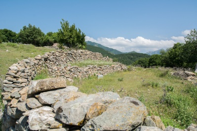 In Papikio mountain and particularly the section of the Rhodope Mountains between the rivers Kompsatos and Traos it had been developed the first Byzantine monastic state. After the raids of ...
Kalogeriko
 The "Kalogeriko" as it prevailed eventually to be called by locals, is the monastery of Vatopedi on Mount Athos, which was built in the second half of the 19th century ...
Valley and Waterfall of Fonias River
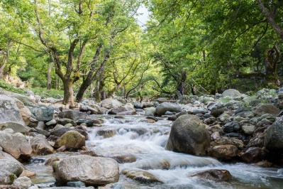 The route for the Cape of Fonias passes through the riparian forest with ancient trees, alders and ferns, and leads to the waterfalls of Fonias. Within dense vegetation and from ...
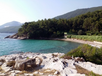
Skala Potamia
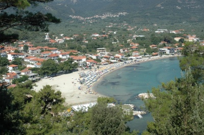 The beach of Skala Potamias is beautiful with crystal clear waters. After your dip in the sea try sun-dried octopus and octopus balls at the taverns of the village.Sources: http://tourism.kavala.gr/el/thassos-to-prasino-nhs... ...
Karyofyto Settlement
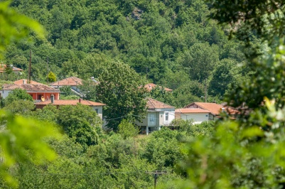 Karyofito is a village in the prefecture of Xanthi, part of the municipality of Stavroupoli and previously named as Kozloutza. It is located 41 kilometers northwest of Xanthi, at an ...
Abdera Settlement
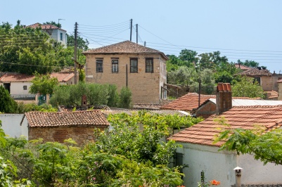 Abdera is located just before the south coast of the Xanthi Prefecture, 20 km away from the city of Xanthi. Today Abdera is north of the famous ancient settlement, but ...


- [Home][CULTURE][RELIGION]
- [NATURE]
- BEACHES
- FORESTS
- WILDLIFE SHELTERS
- CANYONS
- RIVERS
- CAVES
- NATURA
- LAKES
- WATERFALLS
- HOT SPRINGS
- MOUNTAINS
- PARKS
- AGROTOURISM
- ALTERNATIVE
- MUSEUMS
- SIGHTS
- [CONFERENCE ][ACTIVITIES][INFORMATION]
- [ΑCCOMMODATION][FOOD AND DRINK][ΤOURIST SERVICES]
- [POINTS OF INFORMATION][HEALTH][COMMERCE]
- [ENTERTAINMENT]
Privacy Policy
×
News
Contact
Copyright©2026. All rights reserved.
Privacy Policy
Intellectual and Industrial Property Rights - Responsibility of the Site and the Region of East Macedonia & Thrace
The content of this portal has been collected and evaluated by each partner of the project (Region of East Macedonia & Thrace, Regional Administration of Smolyan, Regional administration of Kardzhali και Regional Administration of Haskovo) for the area which each partner represents. Each partner represents each region for the implementation of the Action 3.2 "Content Collection" for the approved applitcation form of JTI - TARGET project under "Greece - Bulgaria 2007 -2013" Interreg Call. The content including images, photos, graphics, texts, textures and in general all the data of the portal is in the responsibility of each partner. The content update and upload of each region belongs to each partner which has also the copyright for those content. This means that the content in this portal of all the point of interests of the Region of Smolyan belongs to the Partner Regional Administration of Smolyan. The content in this portal of all the point of interests of the Region of Haskovo belongs to the Partner Regional Administration of Haskovo, The content in this portal of all the point of interests of the Region of Kardzhali belongs to the Partner Regional Administration of Kardzhali, The content in this portal of all the point of interests of the Region of Region of East Macedonia & Thrace belongs to the Partner Region of East Macedonia & Thrace.
Given the nature and the size of the Internet, under no circumstances, including the case of negligence, will the Region of East Macedonia & Thrace is not responsible for any kind of loss caused to the visitor/user of the pages, services, choices and contents of this portal, which one undertakes at one’s own initiative. The portal and the Region of East Macedonia & Thrace do not guarantee that the pages, the services, the choices and the contents will be provided non-stop and without errors and that the errors will be corrected, because each content belongs to the Region that belongs. Furthermore, the portal and the Region of East Macedonia & Thrace do not guarantee that the servers, through which it is made available to users, do not contain “viruses” or other harmful contents. The Region of East Macedonia & Thrace guarantee the correctness, completeness or even the availability of the contents, pages, services, choices or their results only for its Region, not for the other Regions.
Links to other Websites
The Portal and the Region of East Macedonia & Thrace do not control the availability, the content, the personal data protection policy, the quality and the completeness of the services of other web sites and pages to which it directs users through hyperlinks. Consequently, for any problem arising during their visit/use, the user has to address directly the corresponding web sites and pages, which have the full responsibility for the delivery of their services. The Portal and the Region of East Macedonia & Thrace can under no circumstances be considered to agree with or accept the content or the services of the web sites and the pages to which it directs users or to be associated with them in any way.
Applicable Law and other Conditions
The aforementioned terms and conditions of the use of the Portal, as well as any modification of them, are governed and completed by the Greek law, the law of the European Union and the relevant international treaties (like indicatively and not restrictively the Law 2472/1997 for the protection of the individual and the protection of personal data, as completed by the decisions of the Chairman of the Committee for the Protection of Personal Data, the Presidential Decrees 207/1998 and 79/2000 and Article 8 of the Law 2819/2000, as well as the Law 2774/1999 and the European Law (directives 95/46/EC and 97/66/EC). Any provision of the above conditions that becomes opposing to the law, it ceases to apply by right and is removed from the present, without the validity of the remaining conditions being affected in any case. No modification of these conditions will be taken into account and will be part of this agreement, unless it has been officially formulated and incorporated into it.
Contractors: DOTSOFT AE & IKNOWHOW AE
